Process
Identify high-potential mineral zones before committing to costly field campaigns.
Using advanced satellite and space-based data analysis, we rapidly assess vast territories to detect geological anomalies associated with targeted mineral deposits. A fast, cost-effective way to determine where exploration efforts should — and should not — be focused.
- 70–75%
- Detection accuracy
- Up to 2 months
- Stage duration
- Yes / No
- Target-resource confirmation
Identify high-potential mineral zones before committing to costly field campaigns. Using advanced satellite and space-based data analysis, we rapidly assess vast territories to detect geological anomalies associated with targeted mineral deposits. This early-stage reconnaissance provides a fast, cost-effective way to determine where exploration efforts should — and should not — be focused.
What You Gain
- Rapid confirmation of potential target-resource presence.
- Large-scale scanning of exploration territories.
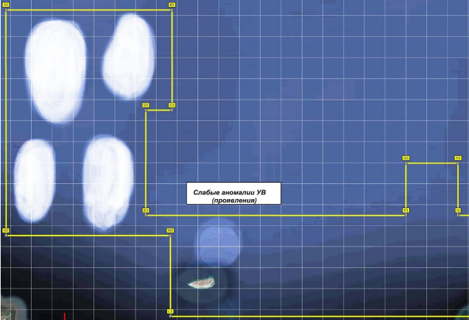
- Detection of anomalous zones linked to possible mineralisation.
- Prioritisation of the most promising targets for follow-up work.
- Significant reduction of unnecessary ground surveys and drilling costs.
- Faster decision-making with lower exploration risk.
Why It Matters
This first-stage remote diagnosis dramatically narrows the exploration area by isolating high-potential anomaly zones from non-prospective ground. The result is a more efficient exploration strategy, reduced operational costs, and faster progression toward viable discoveries.
Diagram